An acreage listing has a marketing problem most residential listings don’t: the house is often not the main event. A buyer looking at a Langley hobby farm, a South Surrey equestrian property, or a larger Fraser Valley parcel is evaluating land, access, outbuildings, and setting at least as much as square footage and finishes, and ground-level photography simply cannot communicate most of that.
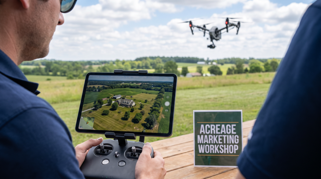
This is the property type where drone photography stops being a nice-to-have and becomes close to essential. This guide covers what aerial media actually shows on an acreage listing, how to combine it with the rest of a media package, and the practical and regulatory notes specific to shooting larger, more rural properties.
Why Acreage Listings Are a Different Marketing Problem
A standard photo gallery, however well shot, tells a buyer almost nothing about how a five-acre parcel is actually laid out: where the usable flat land sits relative to the house, how a driveway or access road connects to the rest of the property, or how outbuildings, a barn, a shop, a second dwelling, relate to each other and to the main residence.
Buyers shopping this segment are also frequently comparing properties across a much wider geographic area than a typical urban buyer would, since acreage inventory is naturally more spread out across the Fraser Valley, Langley, South Surrey, and beyond. That means a listing has to work harder to communicate context that a local buyer touring in person would simply absorb by driving up the road.
What Drone Media Shows That Ground Photos Can’t
A single aerial pass over an acreage property can answer questions a buyer would otherwise have to guess at or ask an agent directly: how much of the lot is usable flat land versus sloped or treed, how far the house sits from the road, where fencing and cleared pasture begin and end, and how the property’s boundaries relate to neighbouring parcels. Listings that include aerial photos have been shown to sell around 68% faster than comparable listings without them, and that effect tends to be strongest on exactly this kind of property, where a ground-level view genuinely can’t do the job.
A top-down or high-angle shot in particular gives buyers something close to a live topographic map of the property, which is often more useful for evaluating an acreage than any single ground photo, however striking.
Mapping the Property: Boundaries, Outbuildings, and Access
A well-planned acreage shoot usually includes a full-property establishing shot from directly overhead, a lower orbit pass that shows the house and immediate surroundings in more detail, and specific passes over any outbuildings, barns, shops, secondary structures, that are part of the sale. Access is worth showing deliberately too: a long or unusual driveway, a bridge or culvert crossing a creek, or a gated entrance are all details that matter to a buyer evaluating day-to-day practicality, not just visual appeal.
Equestrian and Agricultural Features Worth Highlighting
For equestrian properties specifically, aerial media is close to essential for showing paddock layout, ring or arena placement, and how pasture rotates around the property, none of which reads clearly from the ground. Agricultural features, irrigation, outbuildings used for equipment or livestock, cleared versus treed acreage, benefit the same way. These are exactly the details a serious buyer in this segment is evaluating closely, often more closely than the interior finishes of the house itself.
Combining Drone With Video for a Full Sense of Scale
A short aerial video clip, a slow flyover or orbit around the property, does something a still photo can’t: it gives a buyer an intuitive sense of how the different parts of a property relate to each other in sequence, which matters more on a five- or ten-acre parcel than it does on a standard residential lot. Pairing a few aerial stills with a short video clip from the same flight is usually more efficient, and more effective, than treating them as separate bookings.
Floor Plans and Matterport for the Main Residence
Even when land is the primary draw, the house itself still needs proper coverage. A floor plan remains useful for buyers evaluating whether the residence suits their needs, and Matterport can be a strong addition for a larger or unusually laid-out main house, particularly if the buyer pool includes people relocating from out of the area who won’t have the chance to walk through in person before making an offer.
Seasonal Timing for Acreage Shoots
Acreage properties are more seasonally sensitive than most residential listings. Spring and summer show pasture, gardens, and landscaping at their best, while a shoot timed for late fall or winter can make even a genuinely appealing property look bare or muddy in photos. Where the listing timeline allows it, it’s worth weighing whether waiting a few weeks for better ground conditions or foliage is worth more than listing immediately, especially for properties where the land itself is the main selling point.
Regulatory Notes for Rural and Larger-Property Drone Flights
Rural and acreage properties often sit outside the busiest controlled airspace found closer to Vancouver’s core, which can simplify NAV CANADA authorization for a given flight, but the certification requirement itself doesn’t change: a Transport Canada Pilot Certificate – Advanced Operations, aircraft registration, and liability insurance still apply. Larger properties can also mean longer flight times and more battery changes to cover the full site properly, which is worth factoring into scheduling. Our drone photography guide covers the full licensing picture in more detail.
Frequently Asked Questions
Is drone photography really necessary for every acreage listing?
For most acreage listings, yes. It’s one of the only ways to communicate lot size, layout, and boundaries, which are usually central to why a buyer is interested in an acreage property in the first place.
How long does a drone shoot take on a larger property?
Longer than a standard residential shoot, since covering the full extent of a larger parcel properly, including outbuildings and boundaries, takes more flight time than a single establishing shot over a typical lot.
Do equestrian and agricultural features need special shot planning?
Yes. It’s worth walking a photographer through which features matter most, paddocks, arenas, irrigation, storage, before the shoot so the flight plan captures them deliberately rather than incidentally.
Is Matterport worth including on an acreage listing?
It’s most useful for the main residence, especially if it’s larger or unusually laid out, or if the buyer pool is likely to include people relocating from further away.
What’s the best season to shoot an acreage property?
Spring and summer generally show land, pasture, and landscaping at their best, though timing should be weighed against the listing schedule and how much a delay would actually help.